How Planet satellites have helped drive down palm oil-related deforestation
Planet satellites have become a valuable tool for monitoring palm oil-related deforestation. Here's how we have use to keep keep an eye of changes on the ground.

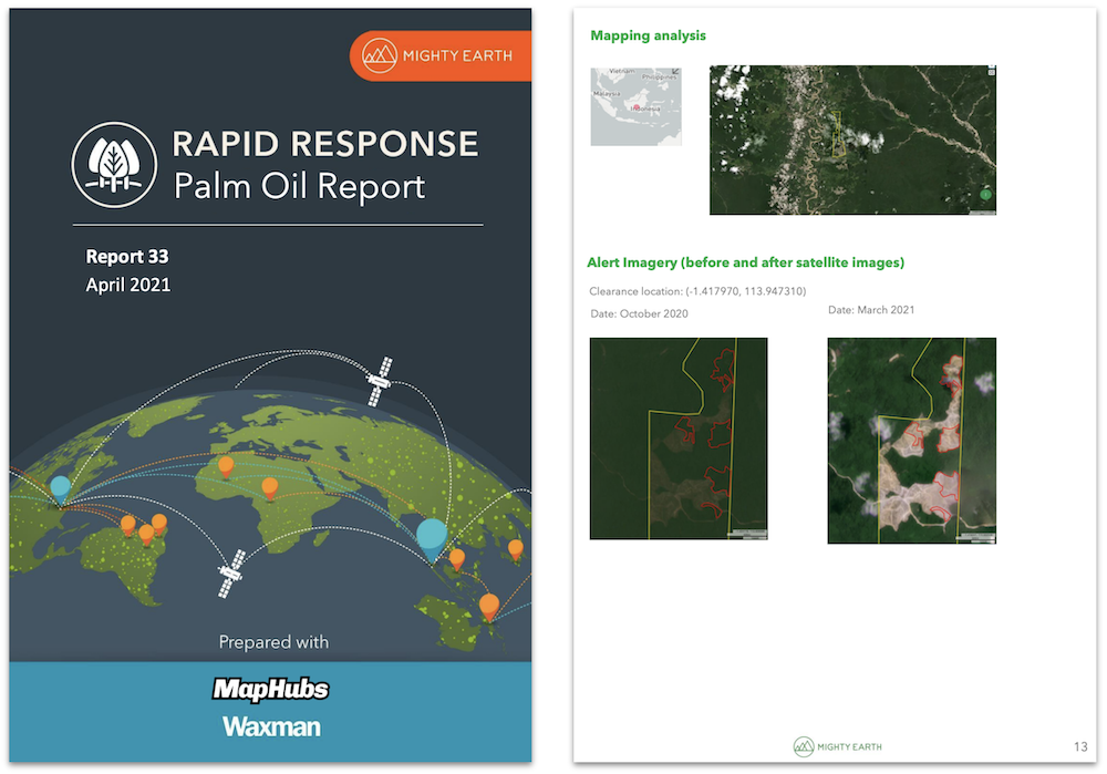
At a conference a few years back, I approached a palm oil company sustainability officer with a new deforestation report. The report documented ten cases of recent orangutan habitat clearance, and we’d linked his company to eight of them. I explained to the sustainability officer that we used forest alerts to calculate deforestation. He was initially dismissive. He asked, “Do you have a satellite image? My suppliers won’t respond to just pixels.” I opened the report and showed the before and after satellite scenes and he acknowledged that this was something that his suppliers were going to need to look into.
For those of us in the deforestation monitoring world, these exchanges are common. The bar for action is set very high, so you need near irrefutable proof that forest was cleared. A key tool in our monitoring toolbox are satellite images - the higher resolution the better. For over 6 years now, MapHubs has been using deforestation alerts in combination with satellite imagery including imagery from Planet - a nano-satellite company. As I am about to attend the Planet Explorer Conference in Washington DC, and I get asked this a lot, I thought I’d explain how Planet’s remarkable shoebox-sized satellites have helped us and many others drive down palm oil-related deforestation.
How it started
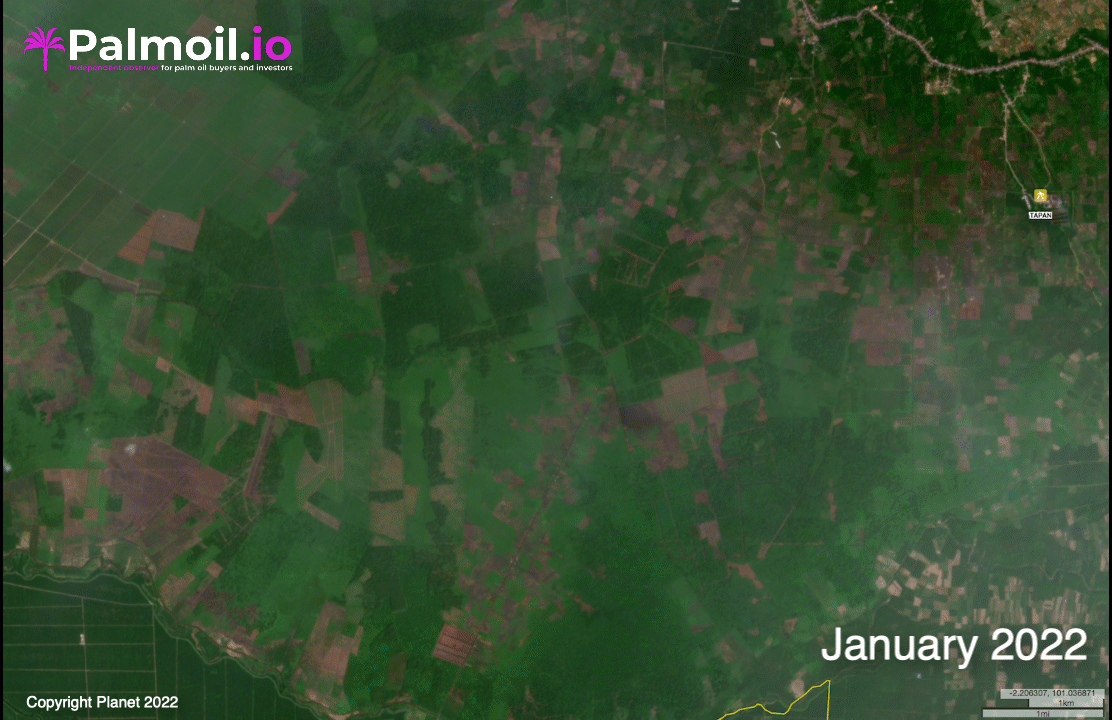
I often joke that we’ve been using Planet before it was cool. Back in 2016, our client, Mighty Earth, was one of the first recipients of a grant to use Planet's satellite imagery for deforestation monitoring. Planet was a relatively new company but was already making waves in the satellite world, launching dozens of tiny shoe box-sized satellites into orbit. The satellites orbited the planet taking scenes of the earth at 3 meter resolution - 10 times higher than Landsat, which was then the standard for forest monitoring. The beauty of Planet’s satellites is there were so many of them, they can image the entire planet everyday. This greatly increased our odds of getting a cloud-free image, even of the often cloudy rainforest.
Turning Planet images into action
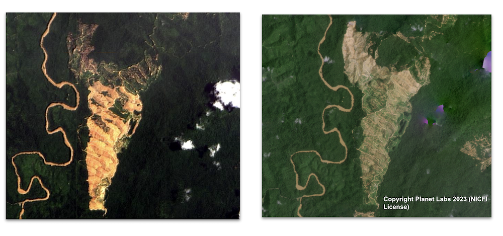
To make the best use of the Planet grant, we helped Mighty Earth develop a Rapid Response system that detected deforestation and linked it to companies who were responsible. We did this by detecting forest change pixels inside thousands of oil palm concessions and pulling satellite scenes from Planet to help us verify the deforestation. We used before and after Planet scenes to trace the actual deforestation and establish when it had occurred.
Rapid Response has proven remarkably successful. Since its launch, the reports have resulted in over 1,000 filed grievances, dozens of supplier suspensions, and deforestation moratoriums. It is fleetingly rare that you see tangible action from forest monitoring, but we can point to locations inside concessions that were about to be cleared but were stopped thanks to the Planet-powered Rapid Response. If you are bulldozing a rainforest, it is hard to argue with a photograph of you doing it, even if it is taken from 300 km above.
Making Planet more accessible
The success of forest monitoring applications such as Rapid Response helped make the case that Planet imagery had the potential to be a global public good. The imagery had proven to be of great utility to both watchdogs and companies, so the Norway’s International Climate & Forests Initiative (NICFI) forged a partnership between Planet, Kongsberg Satellite Services (KSAT), and Airbus to make Planet and other imagery of the tropical rainforest belt more broadly accessible. Through the partnership, everyone can now access monthly cloud-free mosaics Planet imagery for effectively the entire rainforest. It is an incredible resource that provides a valuable component for global forest monitoring, including our efforts to monitor palm oil. There are now over 10,000+ users from indigenous organizations to hedge funds monitoring rainforests.
How we use Planet
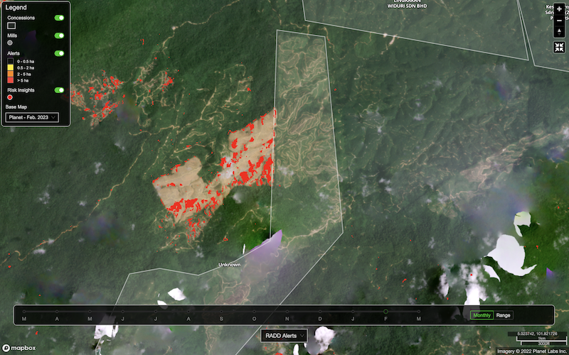
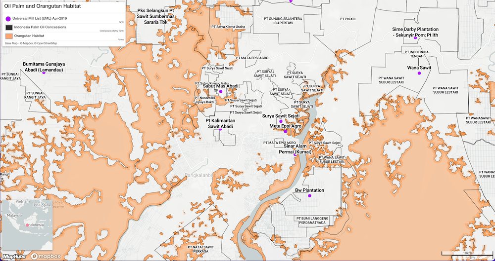
Palmoil.io has added Planet basemaps to our arsenal of data sources. We use them on our mill and concession interactive maps, providing context to new alerts and visualizations of terrain. We also use Planet imagery to review recent deforestation cases. Change detection datasets like GLAD and RADD pixels do a good job detecting deforestation but when combined with Planet, we can more accurately trace the deforestation and make better judgements on the type of forest cleared, its quality, and who did the clearing. For example, if the clearing is industrial, the Planet basemap will show our analyst the tell-tale bulldozed terraces, used to furrow land for palm planting. We can also spot smaller smallholder clearances, combining Planet with our high resolution base map, which reveals if smallholders are planting palm in the vicinity. These help verify deforestation events for Palmoil.io users, which in turn, helps save palm oil companies money. Rather than just depending on an alert, the verification using Planet, gives us a 99% success rate in identifying deforestation. This reduces the need to send field teams out to investigate false alarms.
A model for the future?
The NICFI-Planet Program is arguably a strong model for successful public-private partnership in forest monitoring. Private sector companies like Planet develop the expertise and knowhow around developing and deploying specific technologies. They then build business models to finance and support them. Where there is a public interest in an application of the technology, governments and philanthropies can step in to provide the funding for broader application. In some ways, this is similar to Palmoil.io’s partnership with the David and Lucile Packard Foundation, which gives access and support to our software to local Indonesian NGOs.
Government satellites are still very much needed. The value of NASA’s Landsat and ESA’s Sentinel satellites are incalculable for forest monitoring. After all, they provide the basis for the RADD and GLAD forest alerts that we use. But as we look at the implementation of the EU Deforestation Regulation, making proven technologies like Planet widely available, will help spur effective and affordable innovations, like, ahem, Palmoil.io, so more public investment can be spent on the real work of engaging with deforestation on the ground.