Open data is suitable for EUDR Compliance (if you know what you are doing)
This post explains that open data is useful for EUDR compliance. Criticism from proprietary providers is based on using open data in isolation, which is a strawman argument. Proprietary data is not open to independent scrutiny. Open data monitoring has also been successful in the palm oil sector.

There have been a series of blogposts raising grave concerns about using open datasets for complying with the EU Deforestation Regulation. The criticism is leveled mostly at the JRC Forest Map 2020 and so-called “Global Forest Watch data” specifically Hansen Global Forest Change 2000-2022 (commonly called GFW Tree Cover Loss or TCL). Both are global datasets that have well documented limitations, have undergone peer-review, or are built upon open datasets that have, and are widely used in forest monitoring. As we routinely use these datasets, we keep being asked to comment on these articles, so we decided to publish this post and layout why we believe that these datasets are indeed suitable.
What’s the criticism?
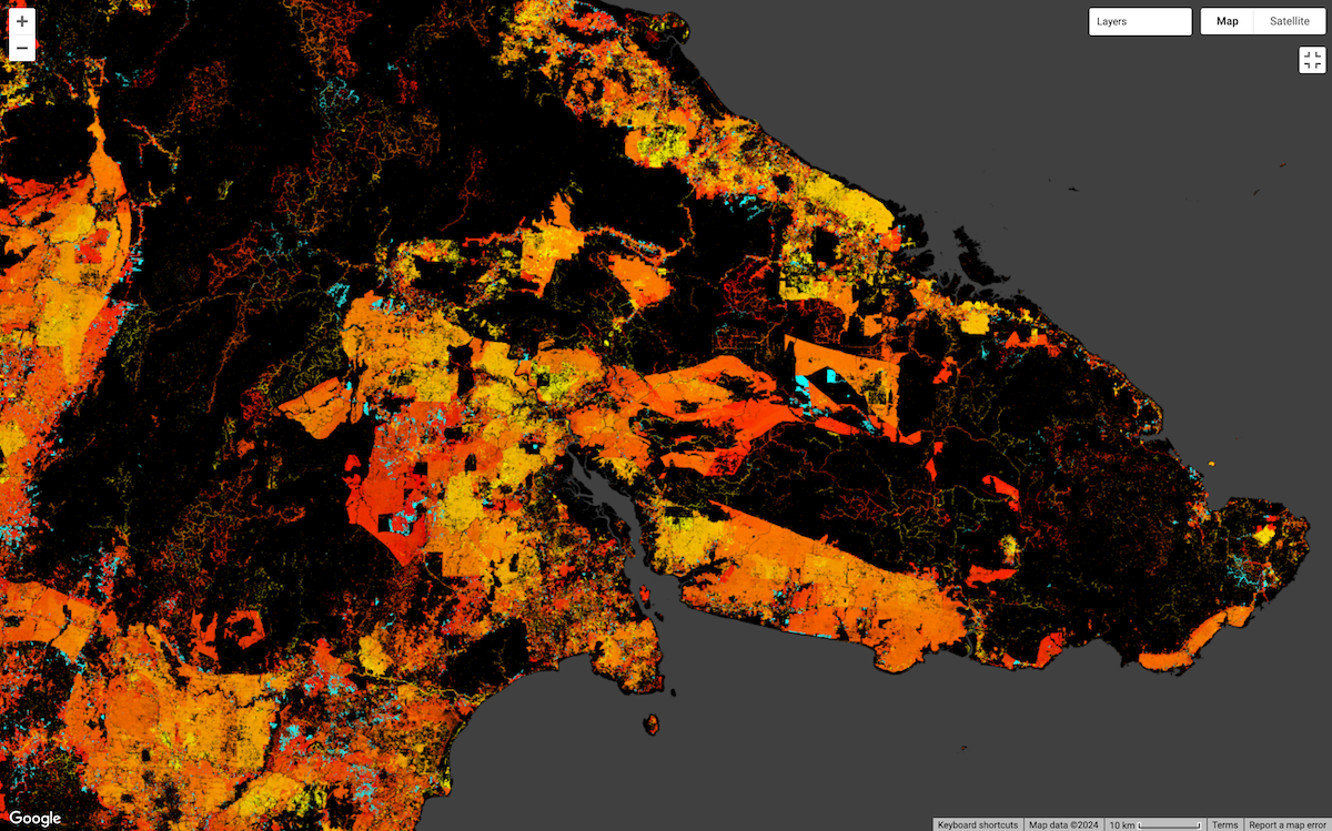
Criticism of open data for forest monitoring is nothing new. It typically comes from the proprietary algorithm community who argue that open data like Hansen and the new JRC Forest Map 2020 are too unreliable to use for EUDR compliance. Using the peer-reviewed literature underpinning open data, they point out that Hansen’s data does not distinguish between tree plantations and natural forest cover, that they are ineffective in complex mosaic landscapes like those found in West Africa, particularly the Ivory Coast. They then point out that this could exclude smallholders by wrongly classifying agro-plantations like cocoa as forest. They then go on to argue, again using selective examples from complex mosaic landscapes like CDI, that their proprietary algorithm is more accurate and using open data is not as reliable.
As professional forest monitors, we want to point out that first, suggesting that everyone using open data plans to use them individually in isolation, and without accounting for known limitations, is a strawman argument. Second, proprietary data often has similar challenges and limitations and therefore should also be independently reviewed with the same level of scrutiny before being trusted for EUDR compliance. And third, open data approaches have proven to be very successful. Palm oil monitoring proves it.
Open data does not need to be used in isolation
We certainly hope that no EUDR vendors are planning to use just a single global dataset like TCL to check that plots are deforestation-free. Deforestation monitoring is a complicated business, and it is important to use a vendor that specializes in deforestation. However, we disagree with the implication that proprietary data vendors make that the problem is open data itself.
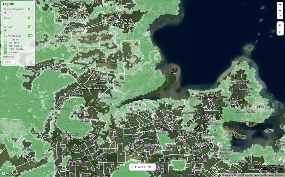
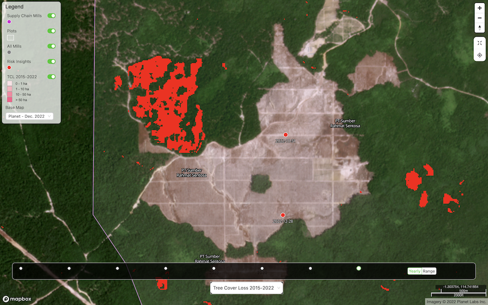
For example, we filter known oil palm areas from TCL, which greatly reduces detecting tree cover loss from replanting. Yes, TCL isn't designed to only show the EU forest definition, but it can be filtered to just EU forest, using the JRC EU layer, and that can be further supplemented with canopy height data from GEDI and country level land class datasets. We also use multiple alert datasets from different satellites, including radar-based data, which helps reduce cloud cover issues. GFW does this on their maps too with their integrated alerts layer.
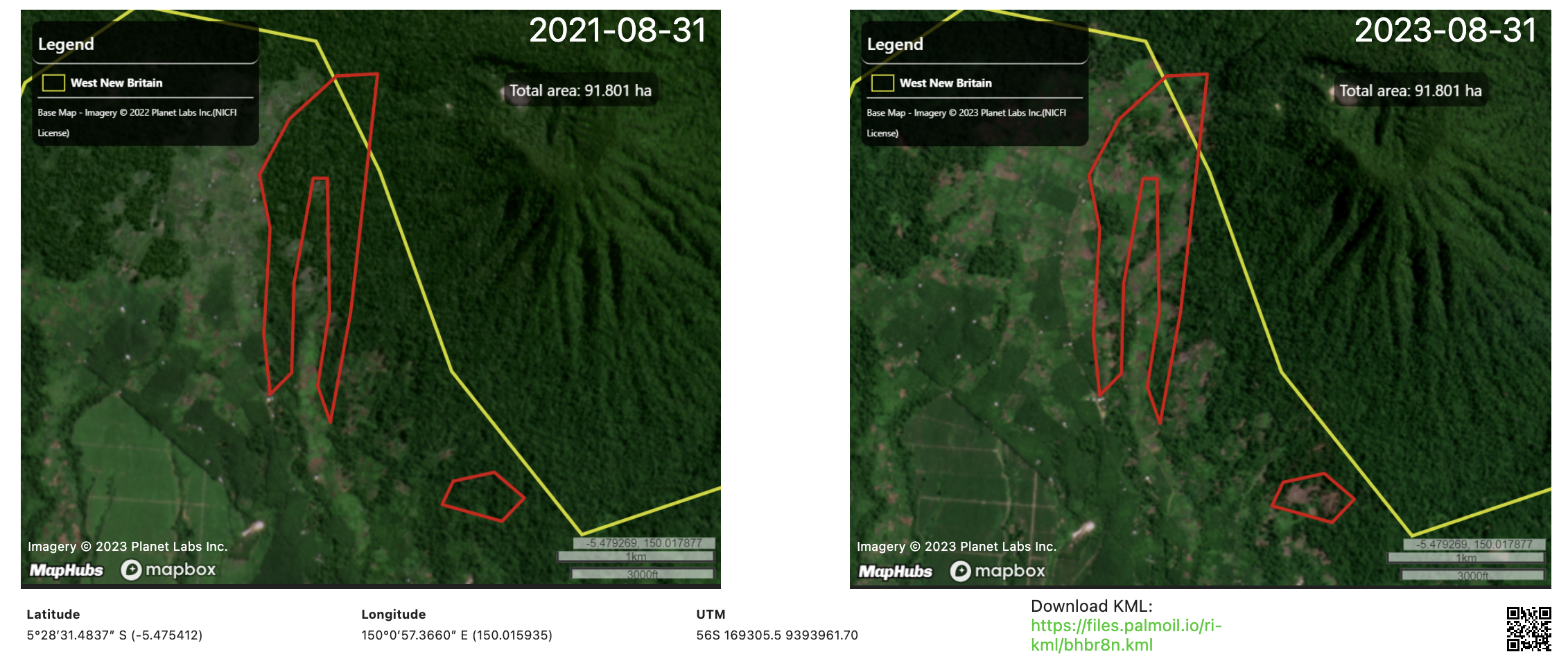
These datasets are just the starting point for monitoring. We always recommend eyes-on with expert reviews, and, if needed, commercial satellite imagery. An analyst will often see when there is something odd in the data, and knows how to look at other sources to verify their findings. It helps that the limitations are so well known, because they know what to look out for. We have reviewed and published over 800 Risk Insight reports using this methodology, and we are ramping up our approach, so we can review on the scale required by the EUDR.
Proprietary algorithms suffer from many of the same limitations
Companies making proprietary data also face the same challenges with cloud cover and AI/ML algorithms. Limitations of open data are so well known, because they are open and the hard work of reviewing them has been done already by the academic community. This also makes open data easier to criticize in blog posts. Proprietary datasets, however, deserve the same level of independent 3rd party review. Yes, vendors can make better regional data, with a lot of expensive effort, but you might not need it. Through an independent review, you should know just how many problems might still exist and how your vendor is working around them.
It is always nice to have better data, but that alone does not accomplish an EUDR compliance check. For example, deforestation-free in EUDR requires us to verify that conversion to the relevant commodity has not occurred in a deforested area. A manual review of very high-resolution satellite imagery might still be needed, because the automated datasets are never 100% accurate. If open data can get you to that decision point as reliably, then you may not need proprietary alternatives.
Open data monitoring approaches have been very successful
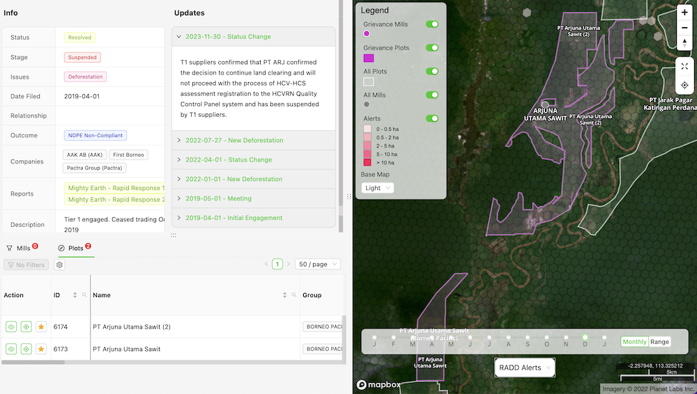
In palm oil, the success of open data approaches is a matter of public record. Visit the grievance tracker of any major palm oil producer or trader and you will find dozens of cases of deforestation allegations submitted by various watchdogs. Grievances always include satellite evidence of deforestation cases and watchdogs typically rely on open data approaches to monitoring and reporting them.
We can see trends with Palmoil.io's comprehensive database of 2,000+ grievances. For example, over 1,000 of these filed grievances were part of the Mighty Earth Rapid Response program that uses open data (TCL, GLAD and RADD) to flag grievance cases. It is backed by our monitoring technology. Of those 1,000+ cases only 14 cases were disputed on whether it was forest or not and none of the companies presented any evidence in support of their claim. While EUDR compliance certainly presents new challenges, many of the same techniques can be applied to confirm that plots are deforestation-free.
EUDR compliance requires a lot more than just satellite pixels on a map
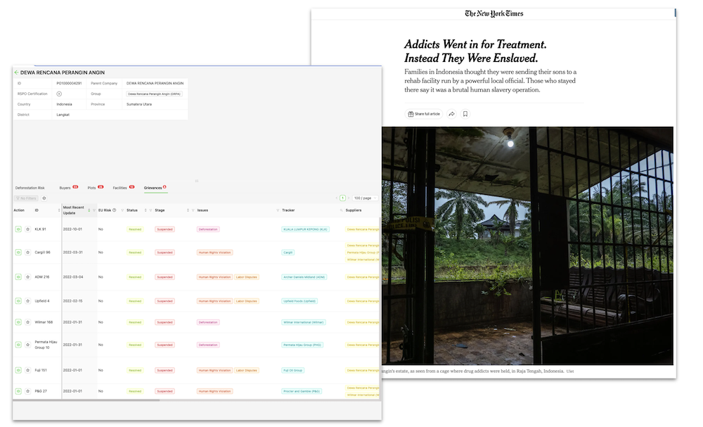
EUDR risk assessments require much more than just simply running plots through an algorithm. It does not matter how accurate your pixels may be if the plot you are analyzing is incorrect or the mill or supplier that you source from has been subject to a corruption conviction.
We add more value than just our expertise in open remote sensing data. We offer geospatially referenced grievances, traceability data, and an entire software platform of insights for over a thousand palm oil companies. By making the most of open data, we keep our costs low and our methods both adaptive and transparent.
The actual demands of the EUDR are daunting to a proprietary algorithm company with little experience working on the ground in forest regions, but it’s our bread and butter. We have spent years doing deep dives into illegal and unsustainable deforestation.
So what’s really going on here?
At the end of the day, anything that is proprietary costs money to make and maintain. It is natural to say your product is better than something that is free or lower cost. However, it is important for the customer to know, if your goal is to get from A to B in the city of EUDR compliance, sometimes public transit is better than a sports car. Even though we are a US company, we believe in public transit, and similarly we think there is value in using open data for EUDR.
For more information visit our EUDR Help Center or email us at team (at) maphubs.com