Palmoil.io Newsletter - June 2024
Palmoil.io's webinar introduced EUDR compliance features, including a Plot and Mills Rating System, Portfolio-Centric Landing Page, 3D maps, and a 6-Month EUDR Risk Assessment Subscription. The website was also updated for better user experience.

Palmoil.io recently hosted a webinar to introduce new compliance features for the upcoming EUDR like New Plot and Mills Rating System, Portfolio-centric Landing Page, and New Features Overview. We have also updated Palmoil.io’s website for better user experience. Introducing a new feature allowing users to view maps in 3D for better landscape understanding! And finally, we have a new 6-Month EUDR Risk Assessment Subscription service.
What’s new?
EUDR 2.0 Webinar Recap
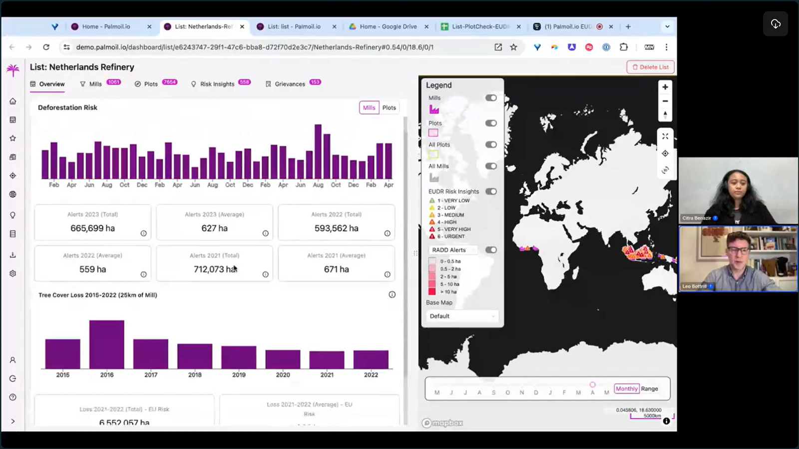
We had a great turnout for this month’s Palmoil.io EUDR 2.0 Webinar! Thank you for your attendance and participation. We introduced the latest compliance features in preparation for the EUDR. Leo talked about Palmoil.io’s new plot and mills rating system, and tools like plot check, and creating due diligence statements; also provided an overview of these new features, emphasizing their importance for EUDR compliance. The webinar was designed for both existing and prospective subscribers, showcasing the new portfolio-centric landing page and the platform's updated elements. We do hope our webinars have been helpful for you to understand a little more about Palmoil.io. Stay tuned for our next session!
To learn more about these features check out webinar here which includes:
- EUDR risk ratings for mills, plots and Risk Insights
- Plot Check, due diligence Excel report download feature
- Conversion checks with evidence of planted palm in Risk Insight report
New site
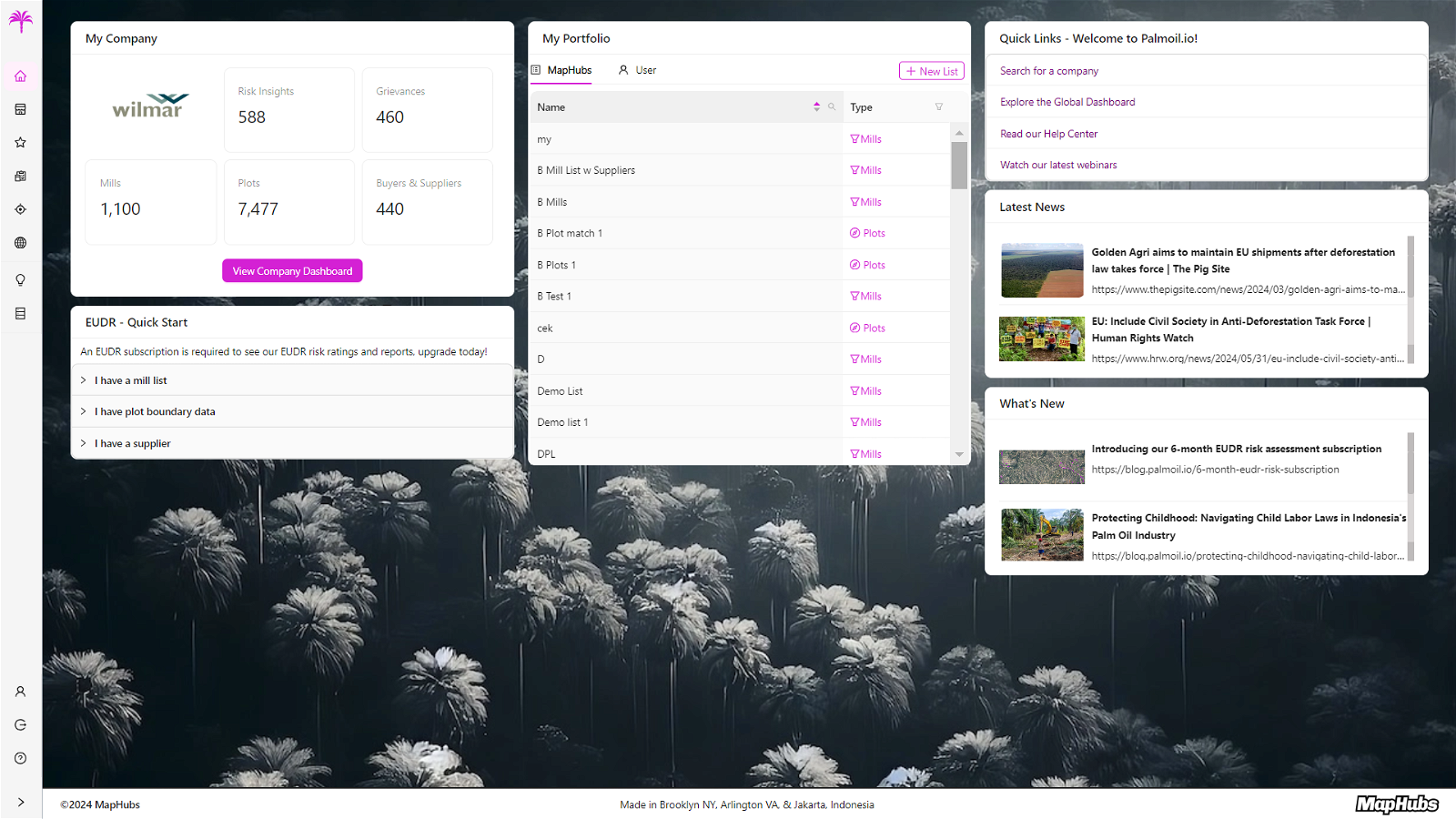
Check out the new Palmoil.io Dashboard!
As you may have noticed, Palmoil.io has a fresh new look thanks to our latest update. The dashboard is now more user-friendly, with key features prominently displayed. Your team’s portfolio is more accessible, making it easier to navigate your primary workspace. Additionally, you can now better visualize your company’s data statistics on Palmoil.io. We’ve also integrated the latest news articles, blog posts, and newsletters directly into the dashboard for your convenience. Quick links to our help centers provide an easy and interactive way to access our EUDR features. We hope you enjoy this revamp as much as we do, as we've put a lot of effort into these improvements.
What’s coming up?
Universal Plot ID Generator
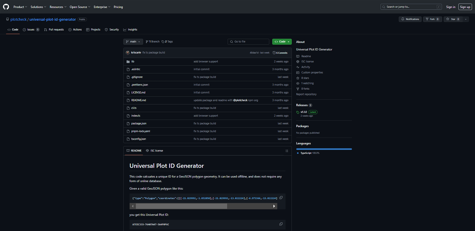
We are adding a universal ID to all of our plots, and to our user’s plot data when they use our Plot Check tool. This helps with tracking data especially between shipments, and interfacing between shipments. Our approach is to calculate the ID from the boundary data itself (using a cryptographic hash) so anyone can do the same and it does not require submitting private data to an online database. In the spirit of collaboration, we’ve released our tool for this as an open-source project at https://github.com/plotcheck/universal-plot-id-generator.
Tip of the month
3D switch of the map
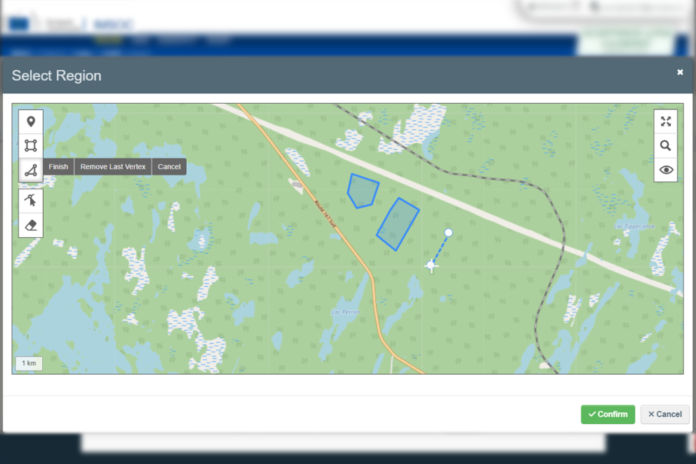
View our maps in 3D
The new 3D switch feature on Palmoil.io enhances map viewing by displaying them in three dimensions. Subscribers can explore palm oil mills and plots with greater depth and detail, improving their understanding of the landscape. This feature makes it easier to observe land usage and identify deforestation related to palm oil production. To use this feature, simply navigate to any map on Palmoil.io and click the 3D button on the right-hand side for an alternative view of your chosen location. Keep in mind, you can always change the map's base layers to gain a clearer perspective of the terrain and land conditions.
Benefit of the month
Start now with a 6-month EUDR risk assessment subscription
To assist companies in preparing for the European Union Deforestation Regulation (EUDR), we offer a 6-month introductory subscription for EUDR risk assessment. This short-term, cost-effective option provides valuable insights using our unique supply chain data that other service providers lack. Recognizing that many companies are still navigating EUDR requirements, our Palmoil.io EUDR Risk Service integrates seamlessly with existing systems, offering vital support and reducing compliance uncertainties. Contact us for more information.
Understanding the EUDR
The EU has released geolocation data requirements for submission to the TRACES information system that will be used for submission of due diligence statements. The geolocation data must:
- Be in GeoJSON format
For people new to GeoJSON, we’d recommend exploring tools like Placemark Play (https://play.placemark.io/) or GeoJSON.io (https://geojson.io) to draw areas on the map and see how they are formatted as data.
And if you want a really deep dive we’d recommend: https://macwright.com/2015/03/23/geojson-second-bite
- Use the WGS84 (EPSG:4326) coordinate system
This is the coordinate system used for longitude and latitude and is what is used by the GPS system. Though in the world of GIS systems there are many map projections and coordinate systems and often data is made in local or national coordinate systems. While the official GeoJSON specification as of 2016 requires epsg:4326 as part of the standard, some software tools do not follow the official spec (https://datatracker.ietf.org/doc/html/rfc7946#section-4)
If you try to load data into the above tools and you get an “out of bounds” error, or your data ends up in the ocean, it may have the wrong coordinate system.
- Have a file size of 25mb or less
For large statements this may require you to import it in multiple parts. GeoJSON is unfortunately not the most efficient storage format. We would recommend removing any unneeded metadata from the properties, and truncating the decimals of the coordinates to the required 6 places. We are updating Palmoil.io Plot Check to automatically do both of these for you, and if needed, split the data into <25mb parts.
- Have coordinates with least 6 decimal digits
EUDR, Article 2 (28) says that the geolocation must use at least 6 decimal digits
This offers about 10cm of accuracy, and is commonly used as a standard for maps that do not require engineering-level tolerances. In general anything beyond that just means slower loading times with no added benefit, see https://xkcd.com/2170/
The source for this is the EUDR, Article 2 (28)
- Be in Polygon or MultiPolygon format (or Point for <4ha)
In the latest version of Palmoil.io Plot Check we automatically support both Polygon and MultiPolygon, and we plan to support Point data soon.
If you need help with geolocation data ,please reach out to support@maphubs.com
You can find more information on the EU system here .